Island Map Project
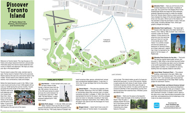
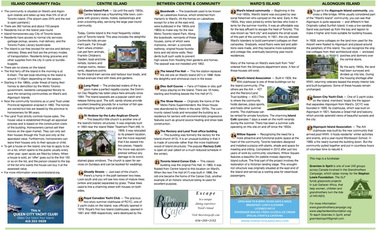
Toronto Island, which defines the southern edge of Toronto Harbour, has been used as a recreational and residential area for well over 150 years. As residents and avid Island history buffs, Toronto Island Grannies in Spirit has developed an informational map featuring 27 historical and natural facts about the area.
Maps are sold to Island visitors during the summer weekends at the Centre Island and Wards Island ferry docks. Each map costs $2.00.
If you would like to order one or more copies, please email us.
All proceeds from map sales are donated to the Stephen Lewis Foundation.
Maps are sold to Island visitors during the summer weekends at the Centre Island and Wards Island ferry docks. Each map costs $2.00.
If you would like to order one or more copies, please email us.
All proceeds from map sales are donated to the Stephen Lewis Foundation.